We woke up this morning and the temperature was a very brisk 25 degrees. We are supposed to be on one of the hottest stretches of trail in Northern California. As cold as it is, I will take this, verse heat any day of the week. The chill does cause us to move a little slower in leaving our toasty sleeping bags.
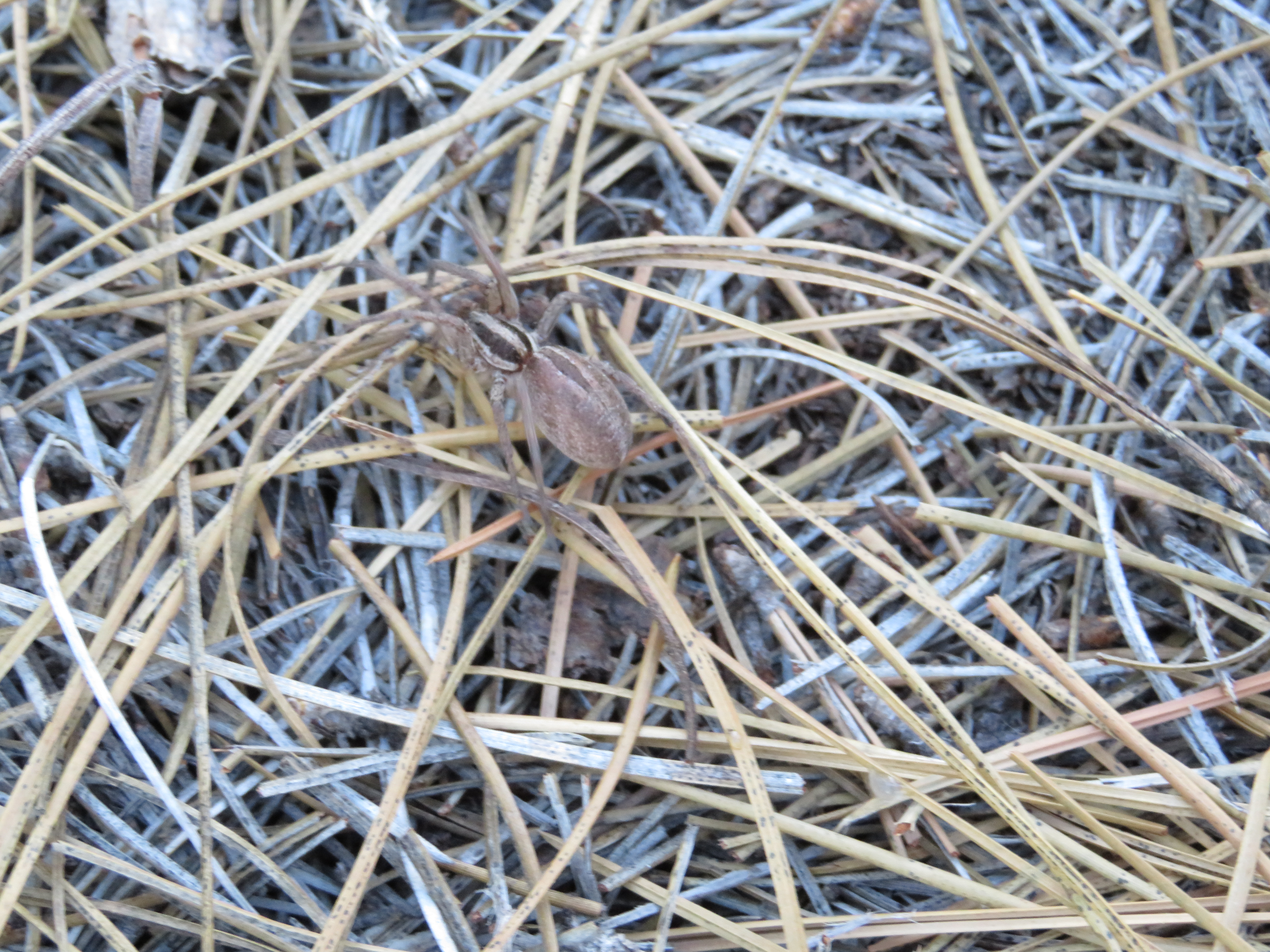
Boot Spider
When I do my preparatory diligence, and shake out my hiking boots, a very large spider falls out. Not sure if it is poisonous or not but I did get a picture. Potential foot disaster averted, we finally get moving at 0805.
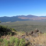
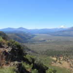
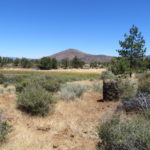
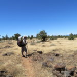
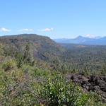
The rim starts out mostly flat with some rolling hills. There is not much in the way and we get a great view of Mt Shasta. It reminds me a little of Mount Rainer as it fills up the horizon with its girth. We are trying to make 4 miles or so to the Hat Creek Lookout before we take a break. Although there is not any reliable water, we do walk above what’s left of a small pond in the middle of a grass filled field. If we were in need of water, it would have been worth the walk down. Since we have enough, we continue on down the trail. The trail meanders just next to the edge of the rim and we are treated to some nice views across the valley below.
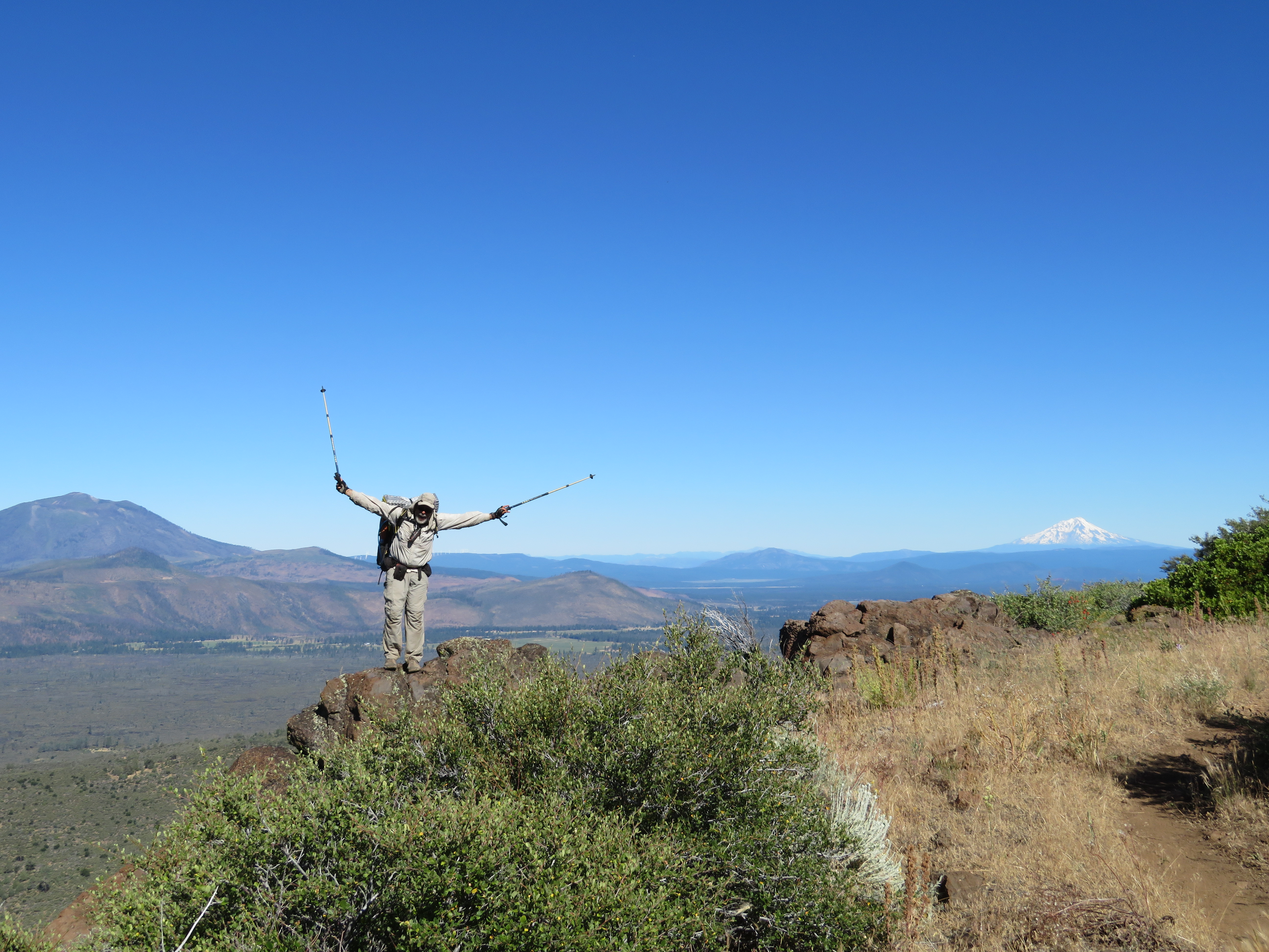
Living on the Edge
I, of course, need to stand on the edge for some photo ops with the valley below and Mt Shasta in the distance. We reach the lookout, which is more of a cell phone tower and take a well-deserved break under a nearby tree.
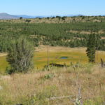
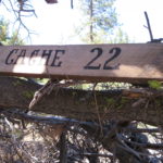
As we continue on, the morning air remains cool. We can see the layers of the rim in front of us, as its plateaus start to get lower and lower. Right before we hit Forest Road 22, we come upon cache 22, where a trail angel has supplied a large number of gallon water containers and some chairs to sit under the surrounding low growing trees. We did not rely on this cache being here, but do take advantage of being able to rehydrate at a greater than anticipated pace. Having chairs just seals the decision that we have reached our lunch spot.
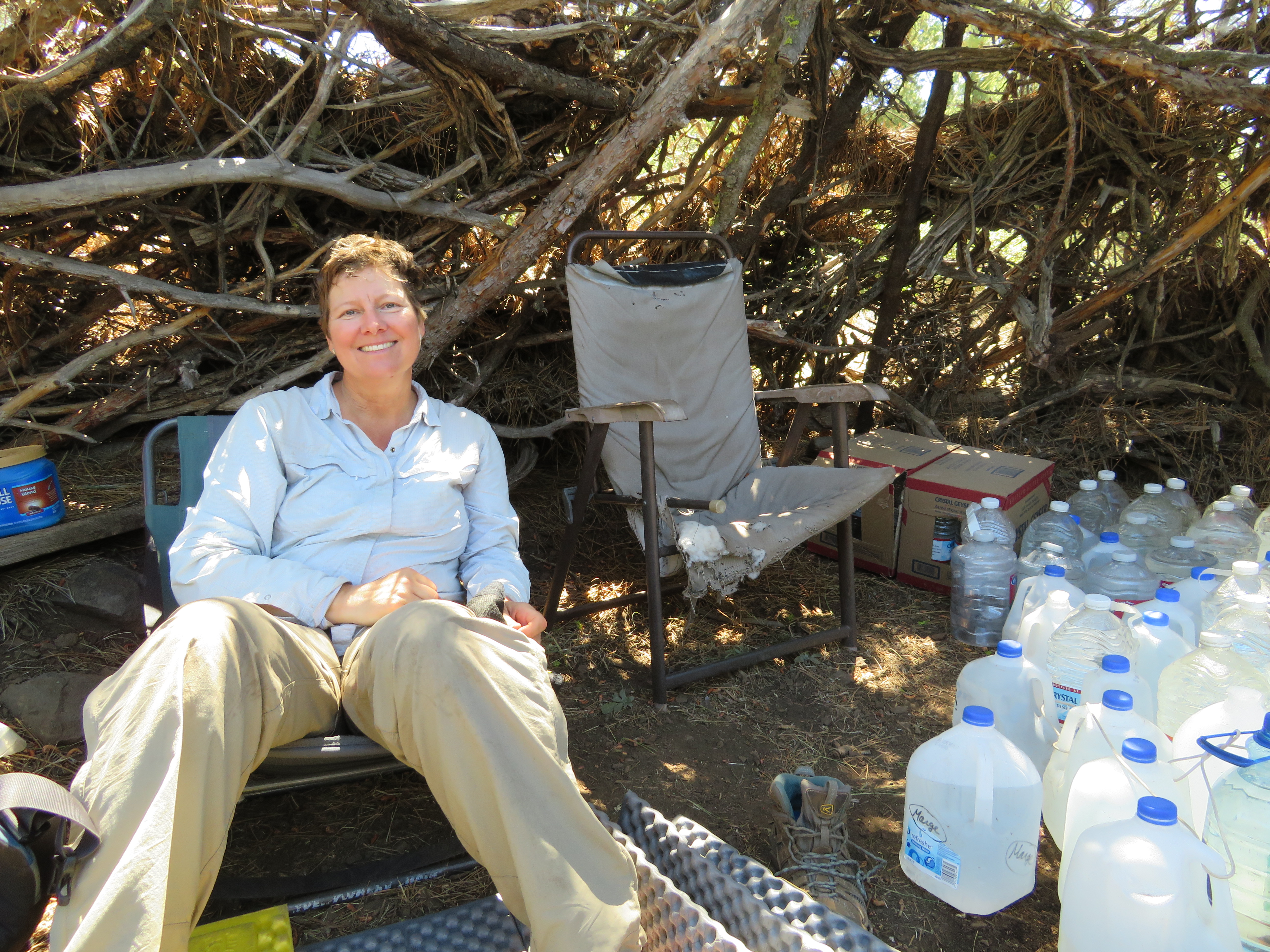
Carol at Cache 22
As we are eating, another hiker comes by and stops for the water and also eats lunch. His trail name is The Dude and he is a teacher from Maine. Before long, we are joined by Nate, just out of high school who is from Massachusetts. He does not have a trail name so we may just have to give him one. We eventually leave our shady oasis and Nate and the Dude, to continue our hike. At some point, PS@ realizes that she left her knee patella at the cache. She decides that we have gone too far for her to go back and hopes that the Dude or Nate sees it and brings it to us. That hope is encouraged as the Dude catches up to us. He does not have it, but says that they did see it and Nate will be bringing it to us. That leads us to switch our previous Just Nate thought for a trail name, to Gentleman Nate.
We As we hike on, the temperature starts to get a little hotter and shade is becoming hard to find. We finally find a tree on the edge of the rim that is throwing off enough shade for the three of us. We have covered about 11 miles of the planned 13.5 for the day and are feeling pretty good. As we rest, Nate comes hiking along and we ask him if he has the knee brace. Unfortunately, we have to take away the Gentleman Nate moniker as he forgot to take it with him. PS2 is disappointed that neither guy carried it from the cache. Nate moves on and we finish up our nice one hour break. We only have about 2 miles to our planned camp, which is right after we come down off the rim.
The temperature has definitely gone up but still not as hot as it was supposed to be. We feel good that we are almost off the rim and thankful for the cooler temperatures we encountered for the rim traverse.
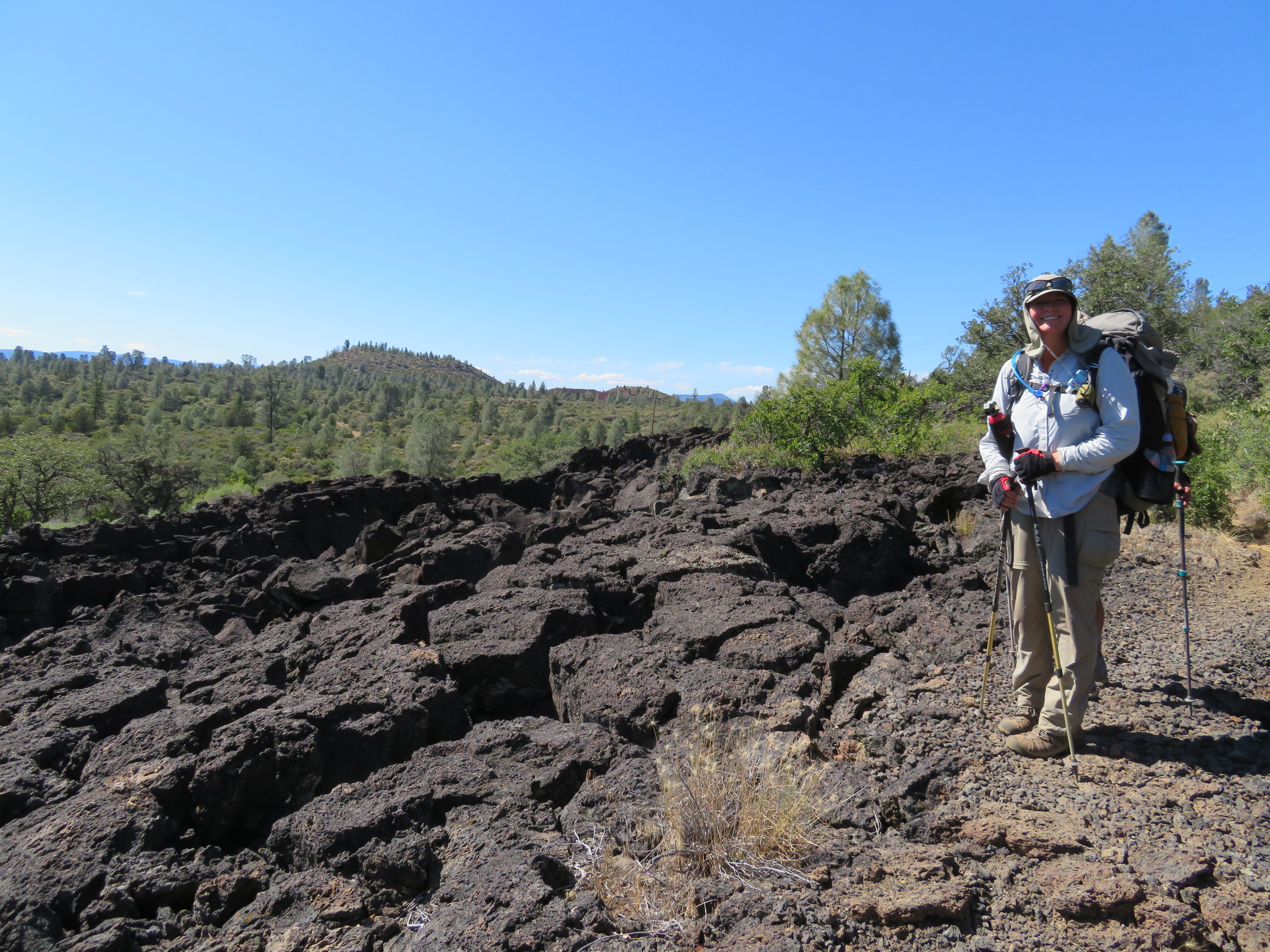
Lava Land
As we descend the terrain becomes very volcanic with large expanses of black lava rock. We make it through and officially are off the rim as we approach our camp spot at mile 1397.6. We have made good time and it is still pretty early in the day. We discuss our options and decide that we will continue another 3 miles or so where the map seems to indicate some flat spots and camp there. This will shorten tomorrows 11.5-mile day and get us to the town of Burney sooner. It will also mean that we will have less distance to get to the next water source tomorrow morning as tonight is a dry camp. So, after a short break, we hoist our packs and head down the trail. While it does become fairly flat, the trail and surrounding landscape is littered with bowling ball and larger size lava rock. After 3 miles, we do not see anything that provides us enough flat non-rock covered space for our tents. It also doesn’t help that the trail is rocky as well which causes us to concentrate on our foot placement so we can avoid kicking the stationary lava footballs.
We reach the paved Cassel Fall River Road and take a short break while we assess the upcoming terrain. While resting, a vehicle pulls off into a dirt turnout by us and the people get out and walk a little way up the trail we had just come from. They do not notice us but I encourage the girls to approach them when they return in hopes of scoring a cold drink. The ploy works perfectly as we chat with them. They are hiking the trail in sections and were looking at doing the rim we just did in the opposite direction from us. We mention if they happen to have anything cold to drink in a manner that would make yogi bear proud. We end up with 3 cans of cold root bear and a crisp apple each. We thank our benefactors and with the added refreshment boost, continue our search for tonight’s home. A mile or so later, we spot a small grove of oak trees and check them out. Not the best spot, but as we haven’t seen anything remotely better, it will do for tonight. We set up camp on a soft bed of leaves. Sounds good except for the thousand ants that start crawling on our tents. We eat dinner in a nearby field and then quickly crawl in our tents and hope the ants do not find a way in. We go to sleep watching them crawl around on the outside of our tent. We added an extra 4.75 miles to our day which turned it into an 18.25-mile day. We hiked at a good pace of 2.7 MPH and are camped at 3340 feet with the high point of the day being 5148 feet. Tomorrow the town of Burney awaits.
-
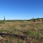
- On the Hat Creek Rim
-
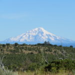
- Mt Shasta
-
- CNC Hat Creek Rim
-
- Possible Water
-
- Valley Below
-
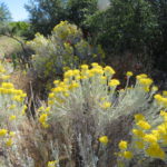
- Yellow
-
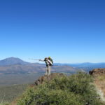
- Photo Op
-
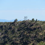
- Hat Creek Lookout (Cell)
-
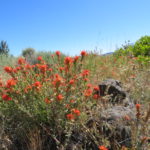
- Indian Paintbrush
-
- Rim Layers
-
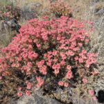
- Purty
-
- Lunch Spot
-
- Trail Angels Water
-
- More Non Existent Water
-
- Lava Rock Everywhere
-
- The Rim and Shasta
Love your new web page. Lotssa snow on long Islad this week!
Love your new webpage. Still following your ventures. P.S. Charlie, lottsa snow on long Island. More late March!
Temp here in Oklahoma City is 87 today…