Pole Creek Colorado, CO Pole Creek to High Camp by Old Mining Cabin
Carol Touched By Angels
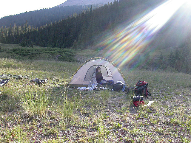
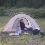
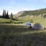
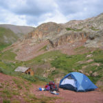
August 14, 2004. We wake up this morning and the rain-fly, plastic bags covering the packs, and Carols wet boot were all covered in frost. We are camped at about 10,950 feet and it is brisk out, so we wait for the sun to start peaking over the hills before we venture outside. We place Carols boot in the sun to dry, as well as, the rain-fly and pack covers. Meanwhile, we take care of nature’s call and breakfast. I take a picture of divine Carol in the tent as a sunbeam shines down on her. I also take some pictures of some weird fin like rock formations behind us. The sun having done its work, we finally pack the gear into our packs. Unbelievably, Carols boot has dried out real well, and she keeps it that way as we cross the creek to get back on the trail. Of course, she used her water shoes to cross. We start out at 9:45 A.M. We are low on water, because even with filters, we didn’t want to fill up where we know cows have been. There is supposed to be a gate that we will pass through shortly, and a stream nearby, so we are hoping it will be cow free. We pass the gate, but there is no stream that we can find, so the Rio Grande River is our next water source about another mile and a half away. We descend down, to the Rio Grande Reservoir Road, and the end of Segment 23 at 10,560 feet. This is not the end of todays journey, as we are hiking well into Segment 24 today.
Segment 24 Rio Grande Reservoir Road to Molas Pass
“He who limps is still walking.” Stanislaw J. Lec
We hike down the road to the Rio Grande River, and much to our dismay there are more cows. Before we make any water decisions, we need to cross the river. It is deep in spots, but we find a way with a little rock hopping, to get across. No removal of hiking boots is necessary. Once across, we weigh our water options, which are basically, fill up some here or go thirsty for 2.5 miles in hopes of the next supposed water source. We decide on filtering enough water to get us further along, and if we find a better source, we will fill up later. Even filtered, the water has a funny taste to it, and that will be enough said about that. Things are not always ideal in the cattle grazing allotment wilderness.
CNC Bear Creek Valley
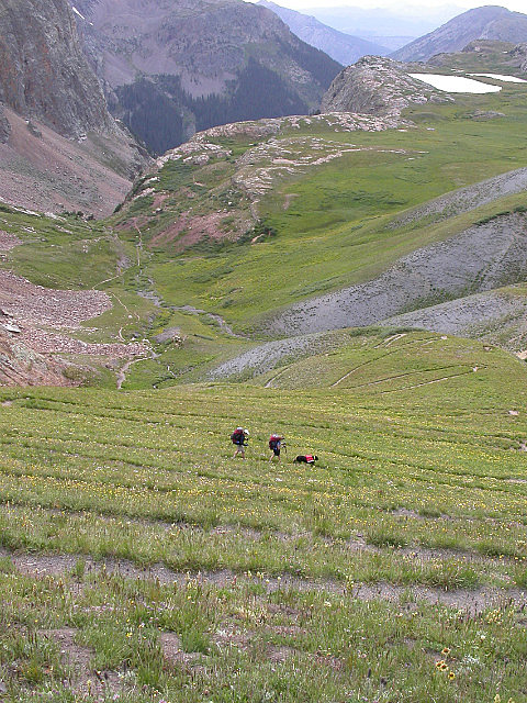
We start on our way again following the jeep road to Beartown. It is a steady ascent to Beartown and we hike through a valley with views of Hunchback Pass and Mt. Nebo. My pack is starting to bother me again. When we get near where the next water source is supposed to be, it is not there. There is a creek about a tenth of a mile away but it is down a steep ravine so we walk on. We soon pass a small, maybe 2 feet wide trickling creek of sorts, and decide it is the best option we have seen to load up on water. There is a 6 to 8 inch deep spot, and the best part is, there are no cows in sight. We fill up and drink a bottle or two, as we had sparingly used the previous foul tasting water. We then fill up all our waterpacks and bottles as this water tastes heavenly. Just a short distance from this creek, we find a nice spot for lunch in the shade of a big ponderosa pine.
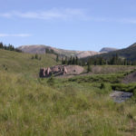
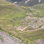
Charlie Mine Cabins and Beartown in Background
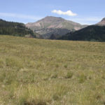
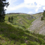
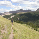
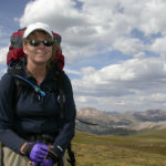
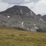
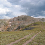
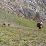
Refueled with peanut butter and summer sausage, we immediately start a climb towards Beartown. We pass the 11,000-foot mark and reach Beartown around 3 o’clock. Beartown is just an old town site with not much left to indicate its prior existence. It is however the place where we get off the jeep road and back onto single-track trail. Roads, even dirt ones, are generally much tougher on the feet as they are packed down, with very little give in them. Over a distance, it really makes a difference in how your feet feel. From Beartown, we start a climb that will involve 1,400 feet of elevation gain over the next several miles. We quickly climb a series of switchbacks until we are at tree line. From here, we can look back down at Beartown and the valley below. As usual, Tim and Jill pull out ahead. Carol is struggling a little but overall is doing better than in the past few weeks. As we traverse across one ridge, we spook a deer. It stops on a slope across from us, and then scampers up it with ease. It is amazing how surefooted they are. It would be nice if we could move so gracefully on that type of terrain. Eventually, we turn west again, as we cross the 12,000-foot threshold.
CNC On Top of the World
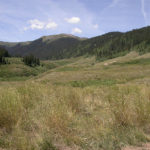
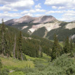
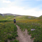
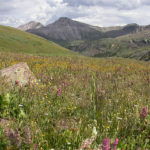
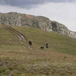
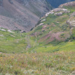
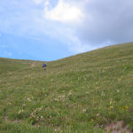
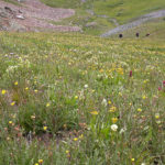
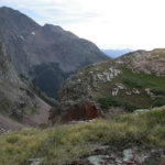
The views are expansive in every direction. Being on top of the world like this can make you feel very small, in the scheme of things. This Rocky Mountain beauty, although hard earned, is well worth the effort. It sure provides me with a type of inner peace that is hard to find in the hustle and bustle world. We begin to pass fields of wildflowers, and I do stop to take some pictures. Across the drainage, we spot some old mining cabins, which look to be in decent shape. What a place this must have been to work in, and then try to get the ore out of. I guess that is what Beartown and the jeep (probably an old wagon road) were there for. As we continue, the guidebook mileage and elevation profiles cease to make sense. We should be further along, and higher, yet we seem to be on the right trail. We have lost sight of Tim and Jill so we stop for a quick snack and to check the maps. My pack is really starting to kill me and I don’t want to walk further than we have to. After convincing myself that we are on course, the journey continues. We catch up to Tim and Jill (more like they waited for us) as we climb up a ravine. The views and scenery here is just incredible. We are well above tree line, and can see for miles in all directions. Not a sign of civilization anywhere. Once again the guidebook, and the trail in front of us does not make sense, but we hike on climbing up towards the continental divide. As we level out the trail starts to match the description in the book and once again I feel good that we are going the right way. We see a large herd of sheep off to our north, and are visited by a friendly looking sheep dog. Chevy seems happy with the canine company. Soon the dog goes back to its sheep guarding duties and we continue on our way. We finally top out at 12,680 feet and walk along a fairly level and wide mesa-like ridge top. As we hike along the ridge, we have views of two small lakes hanging at a cliffs edge on one side. On the other side, we can look back down at the cabins we had passed earlier, and the trail we have traveled on.
Switchback Descent View
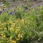
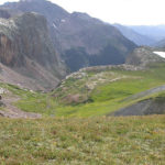
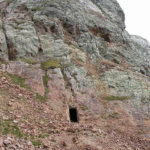
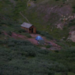
A short distance later, we arrive at a point where the trail will start its descent into the Elk Creek drainage. From this vantage point, we can see our planned stopping point, an old mining cabin, well below us. We begin hiking down a large number of switchbacks, (over 30) as we descend the 600 feet to the cabin. The distance is less than a mile and we zig and zag down the steep slope. The slope itself is filled with wildflowers, which we hope, helps stabilize the trail down. Near the bottom, we pass an old mine carved into the cliffs in front of us. Perhaps the cabin belonged to the miner who worked here. We reach the cabin and find a fairly level spot nearby in which to set up our camp. It is a beautiful spot at the head of Elk Canyon, which we will descend into tomorrow. We can look back up the trail we just came down and see the spot we stood on at the top of the divide. It has been a long but successful day.
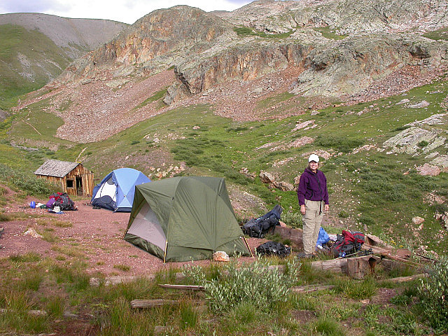
Campsite at Old Miners Cabin
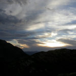
We hiked a total of 10.7 miles and climbed up to 12,680 feet. The total ascent was 2,149 feet. We started at 9:45 A.M. and stopped at 5:30 P.M. Our moving average was 2.4 miles per hour and our overall average was 1.6 miles per hour. I wish my pack felt better, but I am still enjoying the adventure. After setting up our tent, we settle down to a nice meal of Beef Stroganoff and mashed potatoes. We bought a separate bag of instant mashed potatoes, and it worked out really well. It is a filling and satisfying meal. After dinner, I being one who does not like to sit in one place, convinced Carol to climb a small knoll just west of our camp so we can watch the sunset. Although it was not the most spectacular sunset I have seen, it was still enjoyable. Tim and Jill did not watch it with us; in fact, they did not come out of their tent again. We worked our way back down before dark and retired for the night.
-
- Carol on a Frosty 10950 Foot Morning
-
- Jill Chicken Wing Trofholz at Pole Creek Camp
-
- View Back North
-
- Sheep Mountain From the Rio Grande River
-
- Road and Trail to Beartown
-
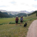
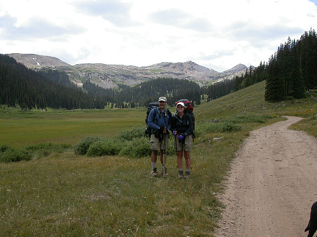
- The Trofholz Trio
-
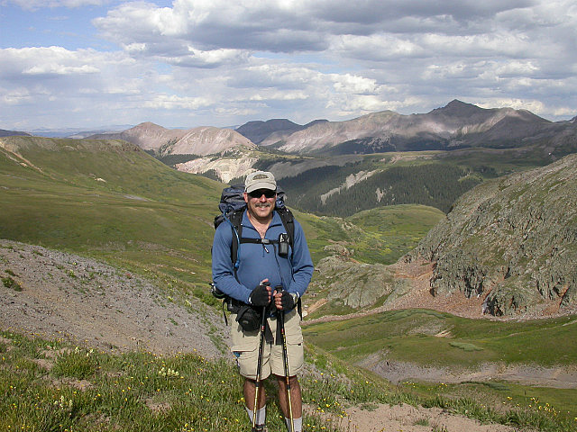
- Climbing Above Beartown
-
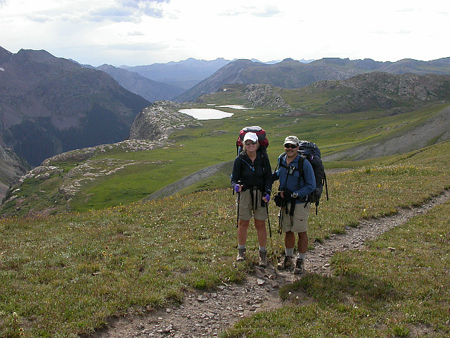
- Looking East Thirteeners on Indian Ridge
-
- Carol Above Treeline
-
- Purple Lupine and Other Flowers
-
- Hiking the Tundra
-
- Flowers and Mountains Near CT and CDT Junction
-
- Carol Topping Out Near 12700 Feet White Dome in Back
-
- Rock and Tundra
-
- Mine Cabins We Had Passed While in Valley
-
- We Could Have Drove
-
- Tim Jill and Chevy at Trail Junction Looking South
-
- Beginning of Elk Creek Canyon
-
- I Think I See Home For Tonight
-
- The Long and Winding Trail Tim Jill and Carol
-
- Looking Up to Charlie Of Course
-
- Mountainside Flowers
-
- Prospectors Dream
-
- Cost of Accomodations With View $0
-
- Elk Creek Canyon View
-
- Sunset Above Elk Creek Camp
-

- Looking Down at Camp
-
- Time to Get Back Good Night
No Comments Yet